… continued from part one.
If the first photo in this post looks familiar, maybe it’s ’cause you’ve read Gwen Maka’s bicycle touring book, Riding with Ghosts.
Ok, here’s the original text (from April 2009):
From Chaco Canyon I took a direct route west to Canyon de Chelley. Many tourists visit Chaco Canyon and Canyon de Chelley on the same trip, but few take a direct route between these sites, opting instead for paved roads and “services”. Sandy stretches east of Lake Valley would thwart most cars, and the snow drifts across the high roads in the Chuska Mountains are another barrier. I was amazed at the desolate desert between highways 371 and 666. On my version of AAA’s “Indian Country” map there’s so much of nothing out there that that’s where the cartographers decided to place the large north arrow. The strong headwind and blowing sand added to the challenge of this section.


On one stretch of double-track I pulled over to let a van by. It was one of the few vehicles that passed me on the road that day. The driver stopped, rolled down her window, and asked, “are you lost?” She was driving “elders” to the senior center. On hearing where I was heading, one old woman was particularly excited since my route would take me right by her house. She described the route, where I could buy a drink in Tsaya, and how to get from there to White Rock. The driver warned that I would ride right through some “housing”, but if I stuck to the main track, I probably wouldn’t get lost.
I had more headwind and blowing sand coming down the Chuska Mountains into Navajo the following afternoon. I hunkered down at the large grocery store in Navajo for a couple hours. Quite a few folks (all Navajo) were interested in hearing about my trip. All were encouraging. The only disturbing interaction was with a preacher who stopped taking his hantavirus meds, opting instead to put his faith in god. Seemed like a bad idea to me.

The wind gave the reservation an apocalyptic feel at times. A day later, after walking down Tse Deeshzhaai Wash to Three Turkey Ruins, I had a surreal conversation with a Navajo man at his remote house where his wife had directed me to the ruins a few hours earlier. We both stood bundled up with our backs to the wind and tried to exchange a few words between gusts which pounded sand on our backs. He made sure I had found the ruins and also told me about a wind storm a month prior that was “worstest” and left about 10 cm of snow in its wake.


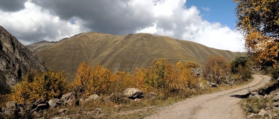
I pedaled on that same afternoon to my first view of Canyon de Chelley at Spider Rock. With the dust and sand in the air I could barely see all the way across the canyon. A little further down toward Chinle, I turned off a side road and found a place to camp only a two minute walk from the edge of the canyon. I could have camped closer if I wasn’t afraid of being blown into the abyss. The morning was clear and calm, and I got my first real view into the beautiful canyon.


Chinle, which had the biggest grocery store of anywhere I visited on this trip (except Moab at the end of the tour), was a disappointment. It’s sprawled out in the sand and dirt below Canyon de Chelley and the Defiance Plateau, low enough to be below the pleasant piñon-juniper forests. There were beggars at the grocery store, and a number of folks told me how dangerous it is to camp in the Navajo Nation. It sounded like the same paranoid danger warnings that I’ve heard around the world.
When I started this bicycle trip, I hadn’t decided which way to head north from Canyon de Chelley. There were a number of choices: north along the west side of the Lukachukai Mountains, NW toward Comb Ridge, or NE straight over the Lukachukai Mountains. I’m a sucker for mountains and had had heard good things about Cove so I chose the latter. What followed was two epic days of riding between Lukachukai and Beclabito. From Lukachukai the road was paved to the top of Buffalo Pass and free of snow even though the signs out on the main Round Rock-Tsaile road indicated otherwise. Through the Navajo Sandstone the road got steep and maintained a phenomenal grade for a mile or two, 14% according to the sign at the top of the steep section. Wow!


The main road headed down to Red Valley. I chose the forest roads to Cove meandering around lakes still mostly surrounded by snow drifts. Abruptly the road descended, and I tried to hang onto my brakes all the way to Cove. Two motorcyclists (I could see their tracks) were the only others who had been along this route this year. I went from ponderosa forest to piñon-juniper and back through the thick layer of Navajo Sandstone again. Long before arriving in Cove, I could see the water tanks and blue roofs that consisted of all I knew about the town. On the steep descent I crashed a couple times and wondered that 4WD vehicles could negotiate such a mess. I felt like I was descending to the middle of nowhere and was blown away when I arrived at the blue roof neighborhood: paved roads, curbs, paved driveways, cars, kids playing, track housing. It was straight out of the 1950s, not the isolated dwellings so typical of the Navajos. I stopped at a yard sale where a family was selling big Navajo tacos for $2 in addition to clothes, DVDs, and the usual yard sale junk. The woman spoke to her kids in English and said that some people called the housing “Smurfville”.


That evening north of Cove three Navajos warned that my plan to continue north the following day wasn’t so good. Even though two of them were on ATVs and were familiar with the track between Buffalo Pass and Cove that I had descended earlier in the day, they didn’t think the route north to Beclabito was passable. Well, as I learned the following day, it is passable… barely. It’s slow and confusing. The only person I saw was a shepherd with a flock of sheep. The track heads up and down, in and out of washes that head east down from the Carrizo Mountains. It was spectacular Colorado Plateau scenery with an edge of adventure.


Nice Christmas reading! Happy Holidays!