continued from part one where we ended in unusually soggy Baker, California.
Death Valley National Park
Heading north of Baker the saddle that separates the Silurian Valley from Death Valley is only about a 50′ climb. From there I left the pavement and stopped at Saratoga Springs to see the incredible wetlands in the desert. I had planned on climbing the Ibex Dunes, but wind was blowing sand off the top of the dunes and everything was still a bit wet from the rain. The following day I reached the pavement, took it for 5 miles and then headed west up Warm Springs Canyon.


The 1400m climb up Warm Springs Canyon was not the longest of the trip, but it was the toughest. The climb started out hard from below sea level in Death Valley and continued to be hard all the way to the saddle leading into Butte Valley. I struggled in my easiest gear (which is really low) the whole way. Surprisingly I walked very little. It always seemed to be just slightly easier to pedal than to walk.


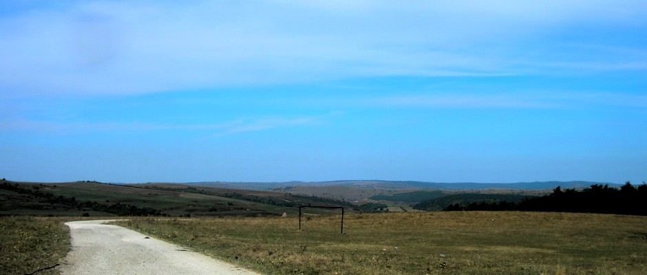
Butte Valley felt remote. The views to the east were phenomenal giving Greater View Spring its name. I could see range after range. I stopped at Stella Anderson’s place and cut some chicken wire to repair my glasses. The rattling had loosened a screw which I couldn’t find. It was important to get a good fix since I wore those glasses a lot riding in the early morning and late afternoon. I found I had about 10 hours of light to ride in with perhaps 45 minutes of twilight on either end to mess around in camp. The sun was theoretically up for 8 or 9 hours, but it was often a lot less than that in the canyons. My repair job worked well, and I didn’t even strip the threads so the glasses are good as new again 🙂


Mengel Pass is rough and keeps too many people from taking this route between Death Valley and Panamint Valley. Down in Goler Wash I met Rock(y), one of two residents of Ballarat. His father is the other. Rocky was poking around Goler Wash with his girlfriend who was visiting from LA. He had worked with various mining operations in the area, and I enjoyed his stories. It was also fun to talk with his Isreali girlfriend. We compared this desert with the eastern Mediterranean desert where I have also cycled.


In Ballarat the following day I talked with Rocky some more, but the girlfriend had already returned to LA. There are a surprising number of springs on the west side of the Panamints (due to faults, I’m sure) and a surprising number of fighter jets playing overhead. I scared a coyote into some bushes near a spring and then was scared myself by the jet passing just overhead. Once the quiet returned I could hear the coyotes, packs of them, howling and yipping in the bushes. The yipping made it sound like there were a lot of youngsters. Fun to hear the bushes make such unusual noises.


Hunter Mountain to Racetrack Playa
I was pretty tired this day and finally made it to Panamint Springs where I had planned to get water. There’s a store as well, but they really only have candy bars. The restaurant, however, was able to sell me some bread and cheese. I bought a veggie burger for lunch as well. That rejuvenated me enough to climb about half of the 1100m paved climb that afternoon.
I was lucky that the following day was stunningly warm since I climbed to over 7000 ft. The 1100m paved climb was followed by 600m of climbing on a dirt road. I’m sure it ended up being more than that since there were a number of descents thrown in as well. To give an idea of the terrain the only two flat places I went through that day were named: Lee Flat and Ulida Flat! Lee Flat was filled with the most Joshua trees I’ve ever seen in one place. I camped in Ulida Flat next to one of the only Joshua trees out there.


I made it over Hunter Mountain, through Hidden Valley, down Lost Burro Gap, and arrived at Teakettle Junction with enough water to be able to make the ~16 mile detour to Racetrack Playa. Of course I’d seen photos of the moving rocks at Racetrack Playa, but I was absolutely blown away being at the site in person. It’s not simply the amazement of seeing the evidence of the moving rocks and all the different directions and shapes of the tracks, but also how well preserved the area is. It wouldn’t take too many people moving rocks from the tracks, driving on the playa, or walking out there when the surface is wet to really ruin the magic of the place. Additionally Racetrack Playa is so big and so flat. The flat playa blends in in the distance with the hills miles away. I loved this place. I was lucky enough to be there when I was. The rain from 5 days earlier had completely dried out, and it rained some more just 10 hours after I was there.


I recovered my stashed gear and water at Teakettle Junction and headed uphill into a cold, stiff wind climbing out of Racetrack Valley. By this point in the trip I had started to associate Joshua trees with cold weather. At the saddle in the twilight I made it my goal to descend far enough down to get away from the Joshua trees and perhaps into warmer weather. It was practically dark by the time I got off my bike, but I succeeded! It sprinkled off and on all night, but I was dry and fairly warm.


The downhill continued all the way to the pavement at Ubehebe Crater, but I had to push the bike a bit once I got to the lava/cinder area. The black sand of the roadbed was much finer and deeper than the surface of most of the descent. Getting to Ubehebe concluded what I had planned for this trip. The only thing left was to get to Las Vegas.


Wait, wait — Vegas isn’t so close. Still one blog to go!
Wow! Just beautiful! And very different from our experience in Death Valley (some day you will get our write-up and photo journal) just as your experience was in Saudi. Best wishes, Derek and Jennie