Bicycle touring the Colorado Plateau, part four: the Abajos, Needles, and Lockhart Basin

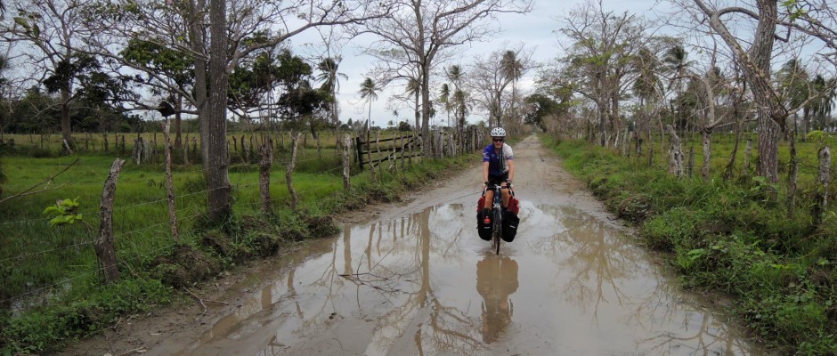
Continuing (north) from my hiking adventures in Cedar Mesa, this is the last installment about my month-long bicycle tour from the Chama River to Moab in Apr-May 2009:

Farther north I hiked in Hammond Canyon from a trailhead in the Abajos and then in upper Salt Creek Canyon from the Cathedral Butte trailhead. I admired a ~20 room Anasazi site in Upper Salt Creek, but I didn’t make it down all the way to the famous pictograph, All American Man. This whole area is so spectacular. I could explore it for months.

Hammond Canyon, Abajo Mountains, UT by bryandkeith on flickr
Hammond Canyon, Abajo Mountains, Utah
Hammond Canyon, Abajo Mountains, UT by bryandkeith on flickr
Hammond Canyon, Abajo Mountains, Utah
Notch Canyon view from the Notch, Abajo Mountains, UT by bryandkeith on flickr
Notch Canyon view from the Notch, Abajo Mountains, Utah
Cathedral Butte, south of Needles, UT by bryandkeith on flickr
Cathedral Butte, south of Needles, Utah
The different versions of Trails Illustrated maps put the various archs in different places so I'm not sure which arch this is. Upper Salt Creek, Needles District, Canyonlands NP, UT by bryandkeith on flickr
The different versions of Trails Illustrated maps put the various archs in different places so I’m not sure which arch this is. Upper Salt Creek, Needles District, Canyonlands NP, Utah
Big Ruins, Upper Salt Creek, Needles District, Canyonlands NP, UT by bryandkeith on flickr
Big Ruins, Upper Salt Creek, Needles District, Canyonlands NP, Utah

I resupplied in Needles Outpost and walked out to the view point above the Green-Colorado confluence in the Needles before starting the last stretch of my ride: the Lockhart Basin Road into Moab. I had been to the Colorado-Green confluence in both Island in the Sky and the Maze on other trips with Kevin. It was sad not to have him along for the much easier hike to the confluence in the Needles. By this point in the trip it was getting quite hot in the middle of the day so I was spending 3-4 hours resting in the shade in the early afternoon. Lockhart Basin lacked shade, but I found a great spot in a small wash where I fell asleep on a small, shaded slickrock bench.

north end of Bridger Jack Mesa. west of Needles District, UT by bryandkeith on flickr
north end of Bridger Jack Mesa. west of Needles District, Canyonlands NP, Utah
Confluence Overlook Trail, Needles District, Canyonlands NP, UT by bryandkeith on flickr
Confluence Overlook Trail, Needles District, Canyonlands NP, Utah
Needles Overlook, Lockhart Basin Road, east of Canyonlands NP, UT by bryandkeith on flickr
Needles Overlook, Lockhart Basin Road, east of Canyonlands NP, Utah
Lockhart Basin Road, east of Canyonlands NP, UT by bryandkeith on flickr
Lockhart Basin Road, east of Canyonlands NP, Utah
Lockhart Basin Road, east of Canyonlands NP, UT by bryandkeith on flickr
Lockhart Basin Road, east of Canyonlands NP, Utah
Lockhart Basin Road, east of Canyonlands NP, UT by bryandkeith on flickr
Lockhart Basin Road, east of Canyonlands NP, Utah

The following day I climbed Hurrah Pass and was at Pete’s house in Moab before the heat. There, I rested, ate, and chatted with Pete for two days. I had a bit of sore throat/cold at this point, probably because I had worn myself out and hadn’t rested or eaten enough during the trip. I found it hard to rest when I wasn’t sure I had enough food to get to the next store and always had to think about where the next water was coming from. I don’t think I camped next to water once during this trip. The food and rest is something I’ll have to keep in mind for future trips. I seem to be able to get away without a serious rest day on two week trips, but that doesn’t work for longer trips.

Evaporation Ponds, Potash Road, SW of Moab, UT by bryandkeith on flickr
Evaporation Ponds, Potash Road, SW of Moab, Utah

Pete and I bicycled out of Moab one morning, headed north, crossed the Colorado on the highway bridge, and turned SW along the Potash Road on the west side of the river. At the end of the pavement Pete turned around. I kept going and hooked up with the White Rim group at the Shafer Trail-Potash intersection. At Thelma and Louise point, I had my best desert bighorn sighting ever. We had a very fun group for the four days along the White Rim: Topher, Birgit, Mike, Jeff, Barb, and Diann. I tried to take it easy, with lots of time resting and plenty of eating. By the end of the ride Topher and I were already thinking about our Maze trip in October as we looked across the Green River to the canyons we’ll visit in the fall.

Thelma and Louise Point, Potash Road, SW of Moab, UT by bryandkeith on flickr
Thelma and Louise Point, Potash Road, SW of Moab, Utah
Thelma and Louise Point, Potash Road, SW of Moab, UT by bryandkeith on flickr
Thelma and Louise Point, Potash Road, SW of Moab, Utah
Potash Road, SW of Moab, UT by bryandkeith on flickr
Potash Road, SW of Moab, Utah
Murphy A campsite, White Rim Road, Island in the Sky, Canyonlands NP, UT by bryandkeith on flickr
Murphy A campsite, White Rim Road, Island in the Sky, Canyonlands NP, Utah
This entry was posted in Bicycle touring, United States and tagged , , , , . Bookmark the permalink.

2 Responses to Bicycle touring the Colorado Plateau, part four: the Abajos, Needles, and Lockhart Basin

  1. Mike Painter says:

    Great pictures of familiar and unfamiliar sights and places.

    I took my Mom & Dad out to the Confluence in the Needles, though we left Dad under a juniper tree when he’d had enough in the heat.

    • Bryan Keith says:

      There is great hiking in the Needles, and a lot of it is fairly accessible (not too long or steep or difficult) for lots of people. I’d love to get there with my parents as well.

Leave a Reply

Your email address will not be published. Required fields are marked *

This site uses Akismet to reduce spam. Learn how your comment data is processed.