A lot happened this week. When I read through my notes, at times it seemed like it was all heat and flat tires. Certainly there were too much of both, but we also had jandarma excitement, continued language diversity, some stunning scenery, and quite the variety of camping experiences.
From Dersim to Bingöl we crossed Elazığ Province, a one day ride through Karakoçan District.

On the first climb we met talkative Christians converted by US missionaries. They complained about the intolerance and prejudice they suffer because of their religion. They also complained of financial hardship because their American friends couldn’t come to help them this year due to covid 19.
We camped that night at the picnic area above the Zaza town of Sarıcan and the nearby Kurdish village of Bulgurcuk.

That was a mistake as the heat kept the picnickers out talking (too loudly) late into the night.
The next day was a long easy climb on a dirt road that crossed into Bingöl. Near the pass the jandarma stopped us to look at our ids. Turns out one of the few cars that passed us on the road made a complaint to the nearest jandarma. What? That there were cyclists on the road??!! Five soldiers piled into a van and drove 18km and 800m up to look at our ids. Wow, seriously? They let us continue onto Bingöl without incident.
A bit later there was a jandarma checkpoint near the ski area at Yolçatı, but since that was in Bingöl, I guess they didn’t know what was going on in Elazığ (?).
With over 100,000 people Bingöl was the biggest city I bicycled through during this entire 3.5 month trip. We left the city a bit late after having an early dinner but still had plenty of time to find a campsite in the light — unless one gets three flat tires. We were starting to get a little anxious as it was getting dark, but a local teacher, Ali Hoca, stopped us in Güveçli and led us to this fine spot at his parents’ garden:

And it was fine, but it was pretty funny when the real (?) owners of the garden showed up in the morning. We told them Ali’s story, where he taught, the names of his kids, how he made a fire and tea for us when we got to camp, but the two hunters insisted it was their garden, and they’d never heard of Ali Hoca! Thankfully they were friendly too and invited us to pick apples from their trees.
Like our Çemişgezek day when Ferda and Hacer scared each other, Ferda got herself into a frenzy this day — mountains (they’re everywhere), animals (there are no dangerous ones, except dogs), and terrorists (mention “Lice” to a Turk), all got Ferda worked up this day. There are back roads between Genç and Lice, but we took the main (Bingöl-Diyarbakır) highway which is narrow in places and carries lots of traffic. It scared me!
Our bonus was finding this incredible campsite at Bırkleyn Mağarası:


Swimming back passed where Ferda is in the upper photo, you round the corner to the right, and the canyon becomes a cave. The canyon just keeps going out the other side of the “cave”, but I was shivering uncontrollably by this point. The day was hot, but the water, well, brrr.
Crossing Lice the next day was fun. We were south of the mountains in fairly flat terrain. At the jandarma checkpoint in Abalı we were given lots of tomatoes.

Lice’s welcome sign in Kurdish, Zaza, and Turkish (the order is probably not insignificant):

And that night another great swimming hole near Yıldız on the Lice-Kulp border:


We approached the mountains as we approached the district capital of Kulp.


Both Lice and Kulp (districts) are in Diyarbakır (province). I really enjoyed the interactions we had these days — fun conversations, interesting questions. Sometimes it can be the same silly questions about flat tires and aren’t you scared of xyz over and over again. Diyarbakır wasn’t like that. We met a young man, living in Guangzhou recently married to a beautiful green-eyed Kurdish woman who grew up in Germany. Between them they spoke at least five languages.
We had planned on cycling further that day but were hit with a stiff headwind when we turned up the Kulp Canyon so we settled for this campsite near the creek:

We tried to start early the next day as we were told the wind was an afternoon phenomenon. Thankfully the wind decreased as the day went on. The canyon was some of the most beautiful riding of the trip on a good paved road without much traffic.


As we rode up out of the Kulp Canyon, we turned off onto a dirt road. Ferda opted for a ride in a truck for the 6km climb up to Kayalısu.

I arrived about 50 minutes after she did, and it seemed she was part of the family. Everyone spoke Kurdish, but enough spoke Turkish to make communication easy. They gave us plenty to eat, and by the time I arrived had many good questions ready about the US. This region in Muş Province was emptied by the military in the early 1990s (1,900 of the 12,000 settlements in this region were partly or fully emptied in 1993-4), and most people fled to the provincial capital. They’ve started coming back building summer homes.
A bit down the road we asked for permission to camp here:

Initial permission was revoked when the local “komitan” of the jandarma heard about our presence. We were more or less escorted to the local compound at Üçevler. It was dark when we got there but looked like this in this morning:

This is a beautiful region on the south side of the mountains that are south of the city of Muş where I skied a couple years ago. It was here we came across the “koruyucu”, that is, locals working for the government at village checkpoints. Some locals consider them traitors while others welcome their presence. We were stopped at the entrance to every village through here, at least five times. They phoned in to the “komitan” who was of course expecting us at every stop.

Osm shows a direct road to Mutki connecting Ilıca to Özenli. Just getting to Ilıca might be considered a little adventurous:

If you want to head this way, try the road that stays on the south side of the creek heading east from Ilıca. I can assure you that the north road has been closed by a landslide for years, and you can’t even walk it anymore. It took a lot of time and effort to learn the information in the last sentence!
We abandoned our Mutki plan, climbed a bit higher, and had a beautiful, fast, almost 1000m descent to the Muş Ovası via another riverside campsite, this one at Derecik.


“Ova” means plain, and indeed it is (a plain).


I don’t find much flat riding in Turkey so when I do, I appreciate it. With the flat road and (mostly) a tailwind we doubled our average distance that day. And check it out! We’ve really left the Zaza areas behind us:

The three languages are Kurdish, Turkish, and English, but I love that they call the place “Norşên”. In Turkification politics/policy this is Güroymak where you find Kalender Baba Türbesi, an Ottoman tomb.

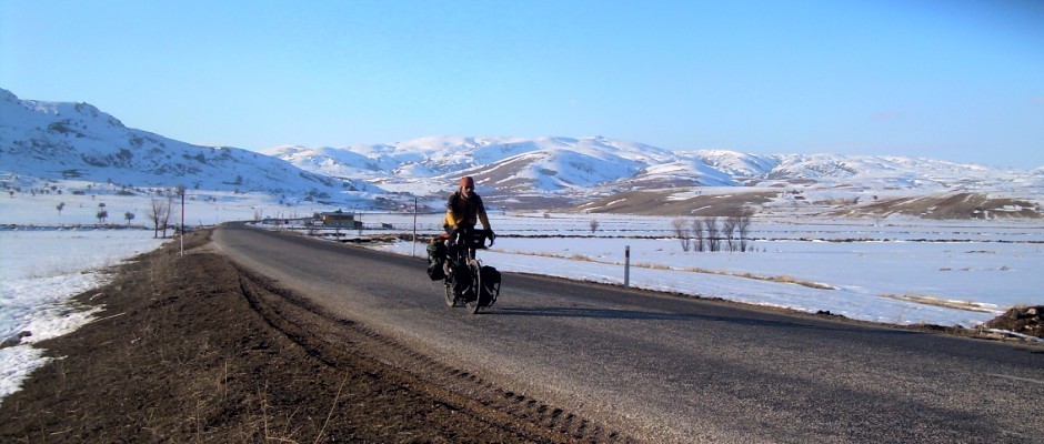
If I look tired, it’s ’cause, well, I am.

Note: when I say “Kurdish”, meaning the language, in this post (and probably every other post I’ve written), what I really mean is Kurmanji. Oh, there’s always more to learn!
Nice post, sounds like great adventure!
Always an adventure!
You look Good Bryan. though i miss that pony-tail 🙂